Using the LTC interactive map
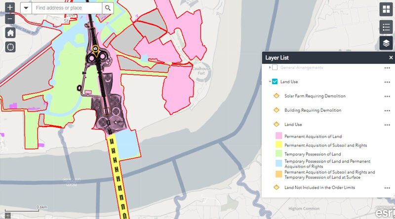
National Highways have released the latest version of their LTC interactive map as part of the Local Refinement Consultation. We’ve
Read More
National Highways have released the latest version of their LTC interactive map as part of the Local Refinement Consultation. We’ve
Read More
Lower Thames Crossing maps (issued 12th May 2022) by National Highways as part of the Local Refinement Consultation documentation. The
Read MoreLower Thames Crossing maps (issued 14th July 2021) by Highways England as part of the Community Impacts Consultation documentation. You
Read More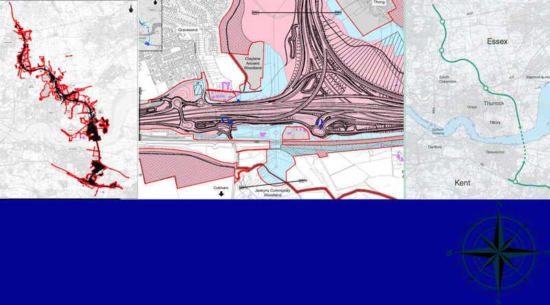
Lower Thames Crossing maps (issued 14th July 2020) by Highways England as part of the Design Refinement Consultation documentation. HE
Read More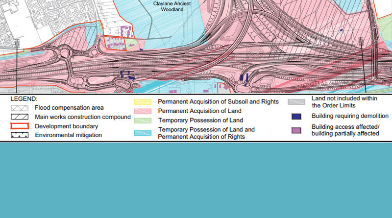
There have been many questions and concerns over what the LTC Map Legends actually mean. The wording of the descriptions
Read More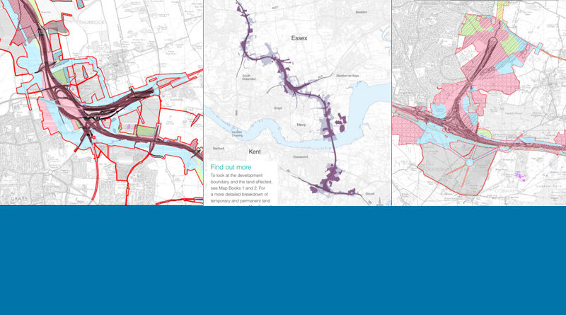
New Lower Thames Crossing maps were issued on the 29th January 2020 by Highways England as part of the Supplementary
Read More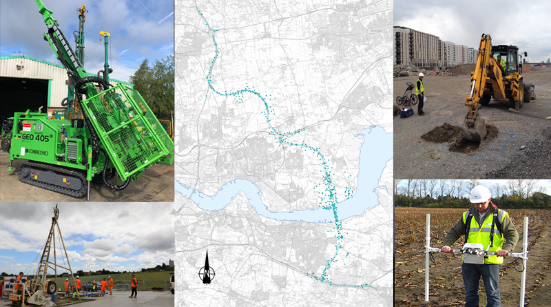
Highways England has today (July 1st 2019) launched a comprehensive programme of Ground Investigations (GI) along the route of the
Read More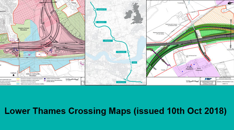
New Lower Thames Crossing maps were issued on the 10th Oct 2018 by Highways England as part of the Statutory
Read More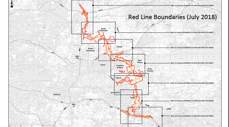
Here are the updated Red Line Boundaries (July 2018) taken from Highways England website. An overview of the route followed by
Read More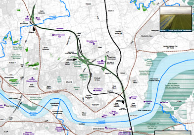
Highways England and the Government have announced that the preferred route option for a new Lower Thames Crossing will be Option
Read More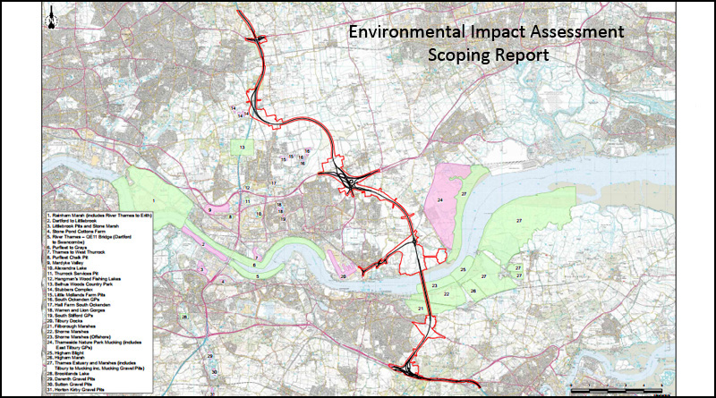
LTC EIA – Scoping Report (inc more maps) or in full Lower Thames Crossing Environmental Impact Assessment – Scoping Report
Read More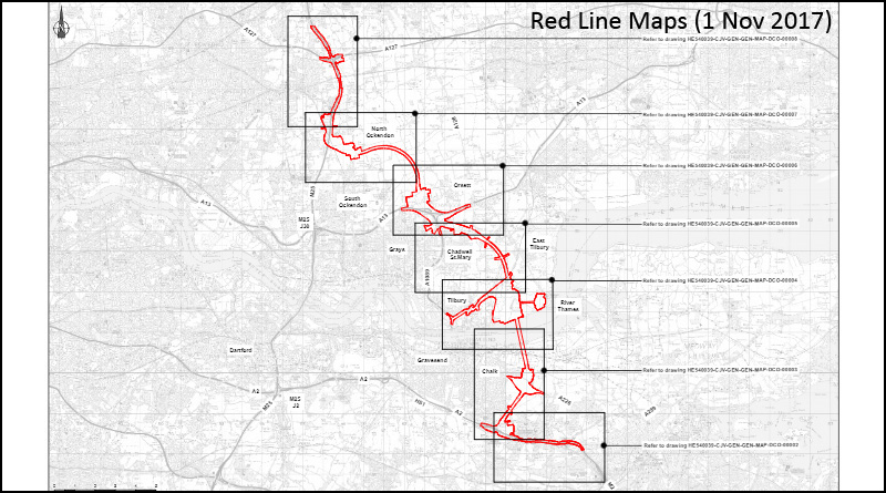
Here are updated Red Line Maps (1st Nov 2017) taken from Highways England website. An overview of the route followed
Read More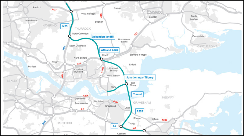
Ockendon | Orsett | Chadwell | E. Tilbury | Kent 1st Nov Highways England Route Update can be viewed on
Read More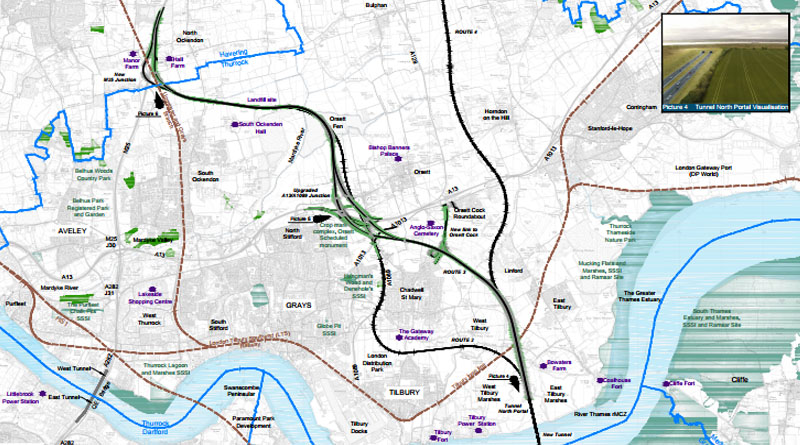
Highways England – Big Maps These maps detail the Kent & Thurrock portions of the road schemes. They are rather
Read More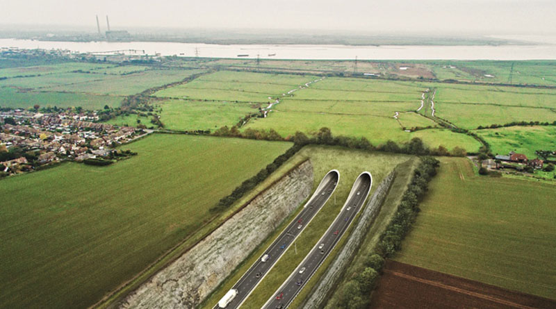
Option C Route 3 Boundary Map This map details the boundary or corridor of Option C Route 3. We expect
Read More