Lower Thames Crossing Maps (issued 29th January 2020)
New Lower Thames Crossing maps were issued on the 29th January 2020 by Highways England as part of the Supplementary Consultation documentation.
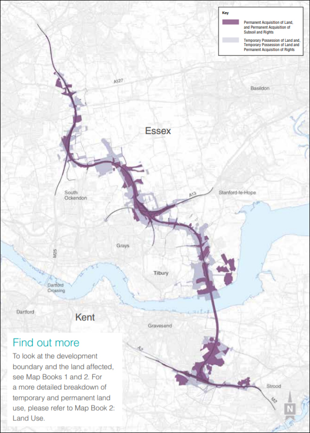
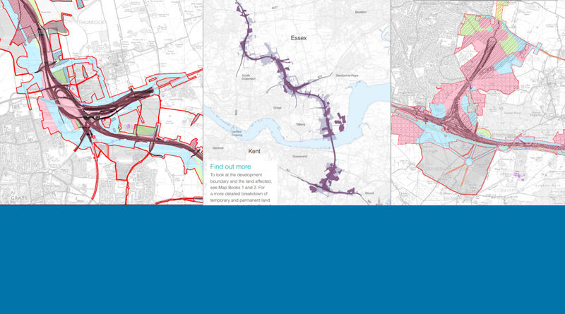
The set of maps that give an overview of the route is the Land use maps – book of six. You can zoom in and out on the map embedded into our site just below here, or alternatively you can click through and view/download it on the Highways England Lower Thames Crossing website. If you wish to view the Land use maps in more detail then Map Book 2 – Land Use Plans give more detail.
LTC Land use mapsClick the + and – to zoom in and out on the images, and the arrows to move through the document in the pdf above.
We are currently waiting definitive clarification from HE, with regards to some questions we have over the meanings of the Legends on these maps. However, to date they have confirmed that the areas shaded grey in Map Book 2 – Land Use Plans represents areas that are NOT within the development boundary. As per the Legend for this map, land shaded pink refers to land that would be needed permanently. Land shaded green would be need temporarily. Yellow seems to represent where the tunnels will run, so the subsoil would be needed permanently. Land shaded blue we believe to be needed in regard to movement/access to utitlities (electricity pylons, gas and water pipes etc). This is our best understanding at this time, we will provide further updates as soon as we receive clarification from HE.
If you feel your property/land is directly impacted we would recommend contacting Highways England with any queries you have. We are not qualified legally, and share the info on this website as fellow concerned residents. We would always recommend seeking professional legal advice if needed.
All maps are available to view, and download on the Highways England Lower Thames Crossing website:
- Map Book 1 – General Arrangements 45.8 MB (PDF document)
- Map Book 2 – Land Use Plans 43.3 MB (PDF document)
- Map Book 3 – Engineering Plans 50.1 MB (PDF document)
- Lower Thames Crossing Supplementary consultation Land use plans for land and property 30.9 MB (document)
- Lower Thames Crossing Supplementary consultation Land use maps – book of six 37.6 MB (PDF document)
When viewing some of the maps you will likely find it helpful to look on Google Maps or similar to help identify places on the the HE maps as the maps that they overlay their plans on are often not very detailed.
A quick overview
This is image shows the whole route which is helpful to get a quick overall view of where the LTC route is proposed to go. Note the Tilbury junction and service station were removed when HE released the LTC maps that were issued on 29th Jan 2020. The Tilbury Link road was removed when Highways England released the Lower Thames Crossing maps that were issued on 10th Oct 2018. It is also worth noting the true impact this proposed route would have, as many think of it simply as a river crossing and don’t realise exactly how extensive the whole route and what it’s impact would be.