
February 2021 LTC Task Force
The February 2021 LTC Task Force meeting took place on Monday 15th. Highways England/Lower Thames Crossing were in virtual attendance again, this time with a presentation on Green Infrastructure.
The HE presentation started with some comments regarding biodiversity, including impacts to things like woodland and the kind of tree planting that is being proposed as part of proposals.
HE suggested that they were proposing twice as much woodland created than lost. and over twice as much hedgerow created than lost. We are not sure how they think it acceptable to try comparing loss of established woodland (some being ancient) with the tree whips and saplings they are proposing to plant.
They also mentioned that they are proposing over 400ha arable land converted to semi-natural habitats. Whilst we’re all for nature and natural habitats we are asking further clarification on what exactly semi-natural habitats are. We also question the loss of arable farm land, especially at a time when as a country we need to be more self sufficient, and the fact that any reduction in farm land means more miles travelled for crops that are lost and have to be brought in from other places.
We could identify with the suggestion of increases in watercourses and wildlife ponds, since most people who know the area are fully aware that much of where they are proposing building the LTC is on or near flood plains and the LTC would just add to that. We’re not sure that is what HE meant, but it’s what we were thinking!
It moved on to the topic of Public Rights of Way, or footpaths, cycle routes and bridleways. There were slides that showed various research they have done into usage by walkers, cyclists, and horse riders in the area. The general theme that they seem to repeat on the presentation slides was that in Thurrock users north of the A13 tended to use these means to get around for leisure. Whereas users south of the A13 tended to use them more for commuting east to west.
They also stated that in Thurrock their proposals would see
- 4.5 km Footpaths upgraded to bridleway
- 8.9 km New or improved ped-cycle roadside tracks
- 3.2 km New bridleways
- 2.1 km Realigned bridleways
- 0.8 km Improved bridleways
- 0.6 km New ped-cycle route away from road
- 1.6 km New footpath
- 0.4 km Realigned footpath
A total 22.1 km new or upgraded routes in Thurrock
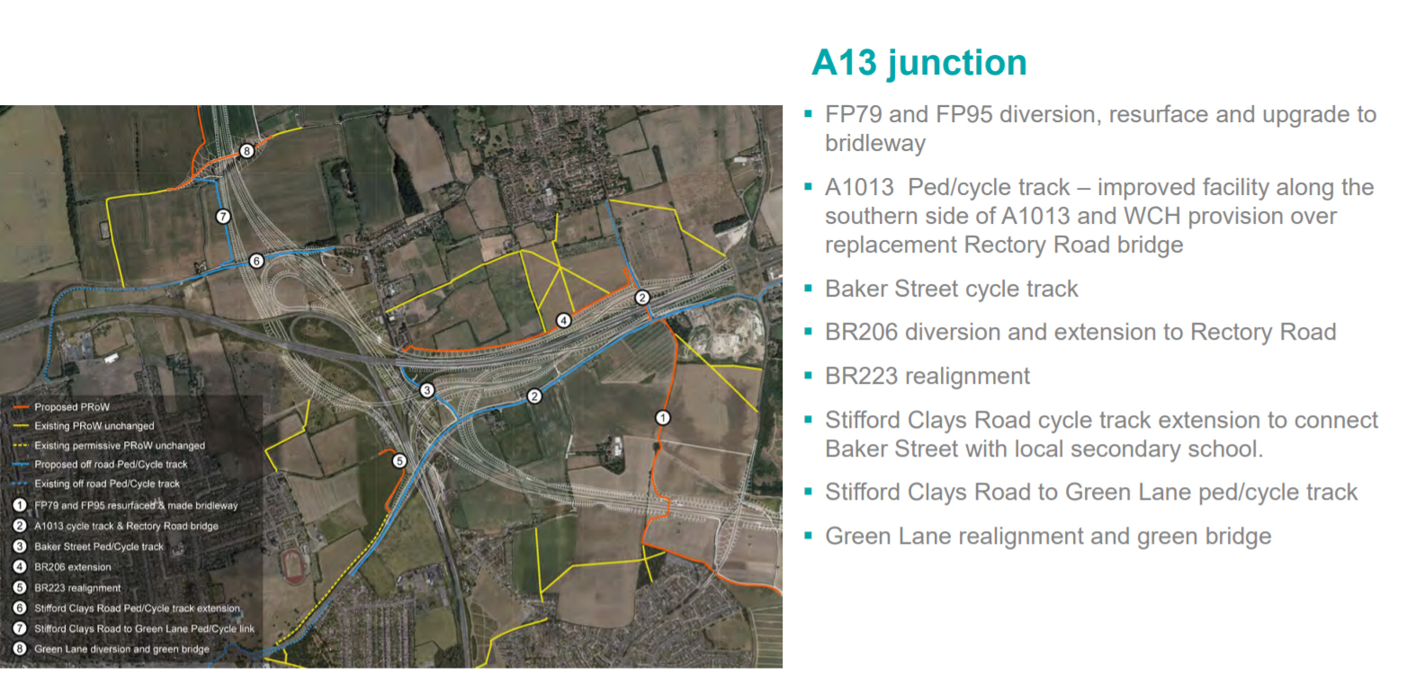
However, when you started to look in a bit more detail we noticed that for instance, HE were labelling a footpath/cycle route along the A1013 (old A13) as a new route. But as we all know there is already an existing footpath/cycle route along there. When questioned on this HE said they were proposing to make ‘improvements’, such as moving the path further away from the road. So in reality taking more land and putting down more concrete on a route that already has a footpath/cycle route. This is not the only case of this we have noticed, and we will be reviewing further.
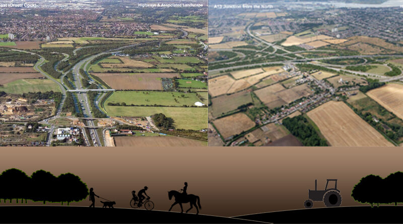
The presentation then moved on to cover ‘Proposals from the previous DCO application in Thurrock’, which included what they refer to as the Ockendon Link (from page 20), the A13 junction (from page 34), and the Chadwell Link (from page 47). Here they gave visuals of some sections of the proposed LTC in these areas (although the ‘Chadwell Link’ appears to be more visuals from the Linford area, rather than Chadwell St Mary). (Don’t forget some other areas were covered in the January LTC Task Force meeting)
There was mention of Rainbow Shaw Ancient Woodland, but yet no reference to The Wilderness in South Ockendon being an ancient woodland. We did question HE on this and they said this was the first they had heard of The Wilderness being referred to as an ancient woodland. TCAG have referred to it as an ancient woodland for years in our consultation responses. So have HE not been reading our consultation responses, or are they just not taking what we are saying onboard? We requested they go away and look into this as local knowledge and history suggests it is an ancient woodland.
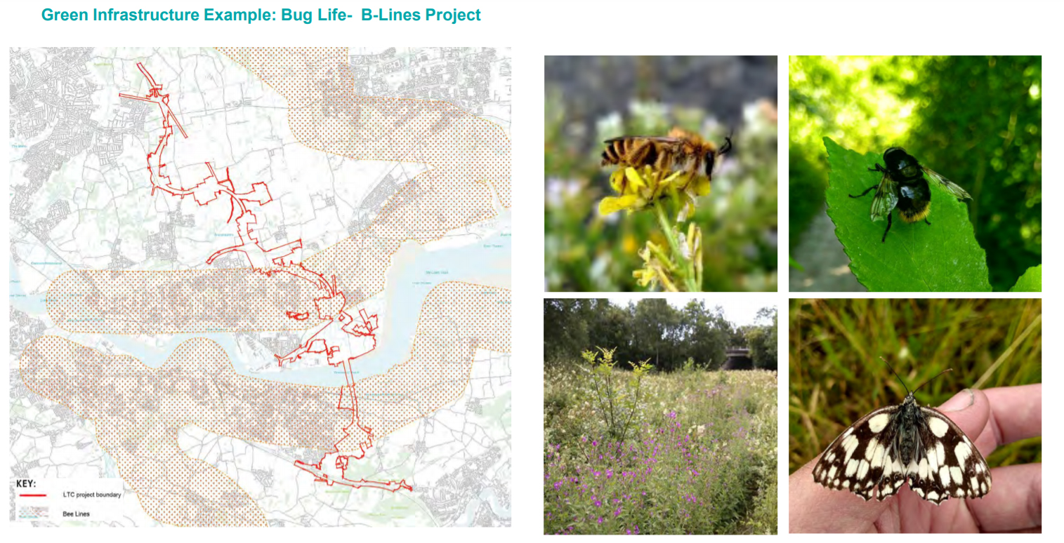
Reference was also made to Buglife B-Lines, which show the ‘insect pathways’ for pollinators such as bees. A map showing these areas and the proposed LTC development boundary was shown, and it was suggested that this was part of the reason for ‘green’ bridges in those areas to allow the pollinators channels to cross LTC! This point was questioned by a number of members of the LTC committee. How do HE expect the pollinators to know they need to cross at the ‘green’ bridges?
All in all, and not surprisingly, we at TCAG were not impressed, and still remain of the strong opinion that there is nothing ‘green’ about the proposed LTC.
View the presentation
Please click through the pages of the presentation and take a look at the visuals.
LTC - Highways England Presentation - 15 Feb 2021
You can scroll through using the arrows
If you are having any issues with viewing our response above it can also be downloaded as a pdf file here
Watch the meeting, including the presentation in full
Here’s the meeting in full, for those that wish to watch either here or on YouTube.
Related
LTC Task Force – https://www.thamescrossingactiongroup.com/ltc-task-force-meetings/
LTC impacts on farmland – https://www.thamescrossingactiongroup.com/ltc-impacts-on-farming/
The Wilderness – https://www.thamescrossingactiongroup.com/the-wilderness/