
Archaeological trial trenching and surveys
We have been informed today by Highways England (LTC) that they will be starting Archaeological trial trenching and surveys in the next few weeks, and they will start in Thurrock.
What are they doing?
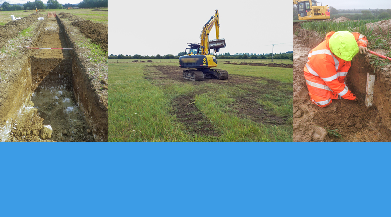
- They are digging shallow trenches to assess the archaeological features of a site.
- Before they dig the trenches, they will undertake non-intrusive electromagnetic surveys to detect any sub-surface anomalies such as utilities, waste and unexploded ordnance. This is a standard health and safety requirement.
What is involved?
- Mechanical excavators will be used to dig shallow trenches approximately 30 metres long and 2 metres wide.
- Before digging the trenches, a magnetometer (detector) attached to an all-terrain utility vehicle will be used to scan the area.
- They will be excavating the soil to look for archaeological features and they will replace the soil once the excavations are completed.
- Noise level will be comparable to that of farm machinery, such as a tractor.
Where will the investigations take place?
- The locations for the trial trenches will mainly be on private farm land on or near the proposed route.
- The work may be visible from nearby roads and properties.
When will the work take place?
- The first phase of these surveys will start in November 2019 and continue until March 2020.
- Most of the work will take place Monday to Friday 8am – 6pm with the possibility of some weekends.
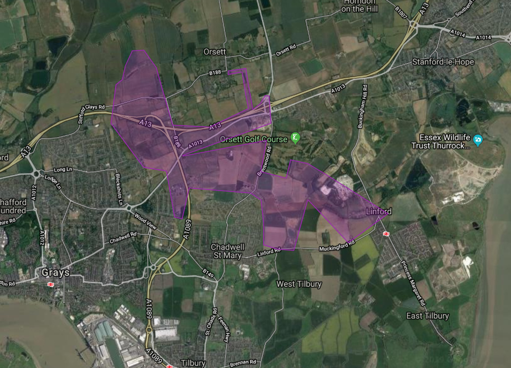
Above is a map from HE website (on Nov 21 2019) showing the area where these surveys will take place in Thurrock. Click the map above or this text to click through to the HE website and view the map in full with zoom options.
Who will be carrying out the work?
- Balfour Beatty will be carrying out these works on behalf of Highways England, alongside Oxford Archaeology who specialise in archaeological excavations. They will be wearing PPE which will be branded with Lower Thames Crossing, working on behalf of Highways England.
Why are HE carrying out these surveys?
- The surveys will enable them to identify and assess any archaeological features along the route. This information will be included in the Environmental Impact Assessment in their application for a Development Consent Order.
You can find further details on how, where and when these surveys will be taking place on their website, including answers to some frequently asked questions.
It is important to remember that these Archaeological trial trenching and surveys are not the start of construction, but are part of the preperation work HE are doing towards their Development Consent Order (DCO) application which they are aiming to submit in mid 2020. They CANNOT start construction until such time that they have been granted a DCO, and once the application is submitted it will have to go through an examination before a decision is made.
UPDATE 11th March 2020 – We have just had confirmation from HE that:
“The results for the ATT survey sites will be fed into the Historic Environment Record (maintained by Essex and Kent) which is a publicly accessible register of known heritage within an area, within six months of the completion of the fieldwork. The reports produced will also form part of the Environmental Statement when it is submitted. In wider terms the ATT is only the first part of the archaeological work on the scheme and there will be a requirement to publish the results.“